


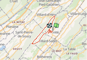
Les Tours de Montmayeur au départ de la Trinité via col de Cochette

ranchoup
User

Length
12.9 km

Max alt
797 m

Uphill gradient
548 m
Km-Effort
20 km

Min alt
334 m

Downhill gradient
548 m
Boucle
Yes
Creation date :
2022-04-12 08:21:02.116
Updated on :
2022-04-12 16:15:48.897
4h44
Difficulty : Easy

FREE GPS app for hiking
 SityTrail
IGN / Geographical institutes
SityTrail Plus
The world is yours!
About
Trail Walking of 12.9 km to be discovered at Auvergne-Rhône-Alpes, Savoy, La Trinité. This trail is proposed by ranchoup.
Description
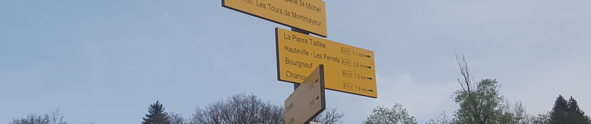
Départ du parking de l'église de la Trinité.
Jolie rando assez facile sur des chemins et routes forestières agréables. Vues sur Belledonne d'un coté et sur les Bauges de l'autre.
Photos


Positioning
Country:
France
Region :
Auvergne-Rhône-Alpes
Department/Province :
Savoy
Municipality :
La Trinité
Location:
Unknown
Start:(Dec)
Start:(UTM)
277146 ; 5042179 (32T) N.
Comments